Technical - Navigation
Ship Steer & Auto Pilot

| Make | Simrad/Robertson |
| Model | AP35 |
| Web |
Connects to almost everything. Waypoints programmed into the GPS (manually or from a PC) are used to contol rudder.
Fluxgate compass / J300x / 2 x NMEA / Radar clock data/ Robnet for rudder contol
Depth & Fish Finder

| Make | Furuno |
| Model | FCV 582 |
| Web |
Gives a very good veiew of what is going on under the hull.
Via NMEA to PCs
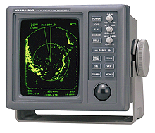
Primary Radar

| Make | Furuno |
| Model | 1931 Mk2 |
| Web |
Open scanner allows longer distance view. Connection to video output feeds Digital signal processor for radar overlay on PC.
Autopilot (for head up) PC for map overlay
Secondary Radar
| Make | Furuno |
| Model | 1721 Mk2 |
| Web | http://www.furuno.co.jp/english/marine/m1721mk2/m1721mk2.html |
Backup radar system
2kW, 18" radome antenna.
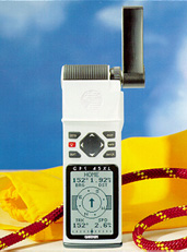
Global Positioning System (main)

| Make | Lecia |
| Model | AP Navigator Mk10 DGPS Professional |
| Web |
Built in Multitrack DGPS Beacon receiver. 2000 waypoints. 3D heading up view. Tide prediction. Large LCD display.
Most things via NMEA and serial interfaces.
Global Positioning System (backup)

| Make | Garmin |
| Model | GPS 36 |
| Web |
Combined GPS and antenna with no display for connection to other devices. Tracks up to 12 GPS satellites.
Via RS232 or NMEA to PC (not connected)
Global Positioning System (hand held)
| Make | Garmin |
| Model | GPS 45 XL |
| Web | www.marinews.com/electronics/electronics/GPS's/e_garmin45xl.htm |
Total: 250 alphanumeric waypoints
Nearest: 9 (automatic)
Routes: 20 reversible with up to 30 waypoints each. 8 channel.
NMEA compatible device (not used)
Depth
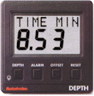
| Make | Autohelm |
| Model | ST50 depth |
| Web |
Hull sensor connects to display depth in metres or feet.
Seatalk then after NMEA conversion to PCs
Vessel Speed in Water

| Make | Autohelm |
| Model | ST50 speed |
| Web |
Hull sensor measures water flow
Seatalk to NMEA converter then PCs
Wind Speed
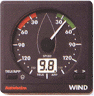
| Make | Autohelm |
| Model | ST50 wind |
| Web |
Connects to wind sensor on mast
Seatalk to NMEA converter then PCs
The above devices are interfaced with two personal computers.
The following marine standard networks are used:
1) Robnet
2) Seatalk
3) NMEA
Their outputs are converted into NMEA format and fed in two Noland NMEA multiplexers each which feeds one of two PCs. This is how each PC gets the same data from all devices.
The two PCs are networked at 100Mb/s
PCs and software are detailed below.
PLODSTAR 1. X86-Based PC & 120GB Hard Disk for Multi use i.e; Windows XP, Navmaster Professional V-5.1.2.2 with ARCS. Proudman Tidal Stream Dat to work with Navmaster. Horizon 3D ARPA Radar & Suoerchart Plotter with ARCS.
PLODSTAR 2. X86-Based PC & 85GB Hard Disk for multi use i.e; WINDOWS XP with office procedures+. NAVMASTER Professional Version 5.1.2.2. with ARCS. Proudman Tidal Stream Data & Weatherfax for Windows V2000. Professional navigator service, main & backup systems with weekly updates.
Toshiba Satellite M60. & Psion Series 3a.